We are Advanced Land Surveys, Like Topographical Boundary Surveys, Leveling Surveys, Building Marking, Layout Design / Marking Etc., All Kind of Land Surveys / Marking / Civil Works Works We Will Done.
we are experienced Land Surveyors. we completed the projects on time schedule.
once take the project we complete maintain that project ends. Have many more satisfied clients. we do all type of land survey services. Layout designing , Road Survey, Property survey, Boundary survey , Topographical survey, contour survey, building survey etc
OUR TEAM EXPERTS.
1) K.Ramalingam, B.E., FIE.
Former Chief Engineer, P.W.D., Government of Tamilnadu.
2) Er.A.S.Prabagar, B.E. (Civil), BBA, MBA, M.Tech.
Chief Executive officer having 28 years experience in survey.
3) Er.A.Periasamy, M.I.E., FIV. FIITA. C.Engr. (India)
Former Executive engineer P.W.D.,
4) K.Saravanan, Bsc (Geography), Chief Surveyor
5) Team of Diploma Engineers and graduate engineers available with us to work at any time.
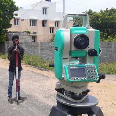
6) Team Experienced qualified surveyors to handle Total station (an electronic equipment) and
other survey instruments for various survey works.
7) Draftsman to draw computerized plan for Topo, Contours and Trigonometry survey work
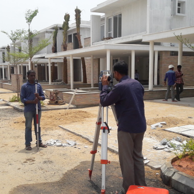
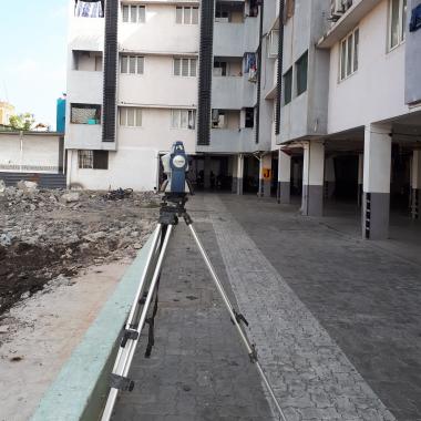
Topographical Survey for different Projects Like Road/Bridges/Tunnels/Rob-Rub/Fly-over’s/Subways/ Land/Industrials/Commercial area/Township Developments/New projects etc. we are doing topographical survey.
Topographical Survey for different Projects Like Road/Bridges/Tunnels/Rob-Rub/Fly-over’s/Subways/ Land/Industrials/Commercial area/Township Developments/New projects etc. we are doing topographical survey.
Ladder Survey Institute Of Technology has a vast experience providing high quality customized training.We use state-of-the-art technology Japanese laser Total Station Instrument with 95%practical training,with rich in Quality & Quantity Knowledge.We know the value of your money.
A to Z Land survey related works,land valuation,Land survey location problem.
Building marking and grid line marking
FMB Sketch ,plot subdivision,
verticality certificate, Supervision for marking work,
coordinate assemble,All type of traverse,leveling,
Property survey,topographical map(railway,bridge,forest,pipe line ,high tension tower)
Contour survey, Volume calculation (Quantity survey),Longitudinal section and Cross section